Have you ever tried to send someone walking directions and Google Maps gives them a route that’s… obviously not the one you’d take?
This happened to me when I was moving out of my apartment in Geneva. I had so many viewings in a few days (if you’ve lived there, you know). The apartment was super close to the train station. You could walk there in a couple of minutes.
But Google kept sending people on a 36-minute detour along a big road.
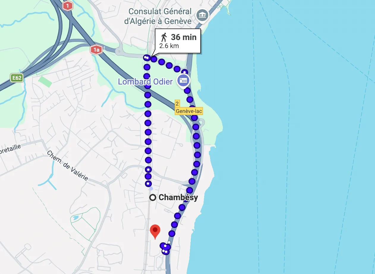
Google Maps suggested more than 10x longer detour route. At least they got to work towards their 10 000 steps a day.
So why do we get this long and dreadful route? Because Google Maps didn’t know the little pedestrian path.
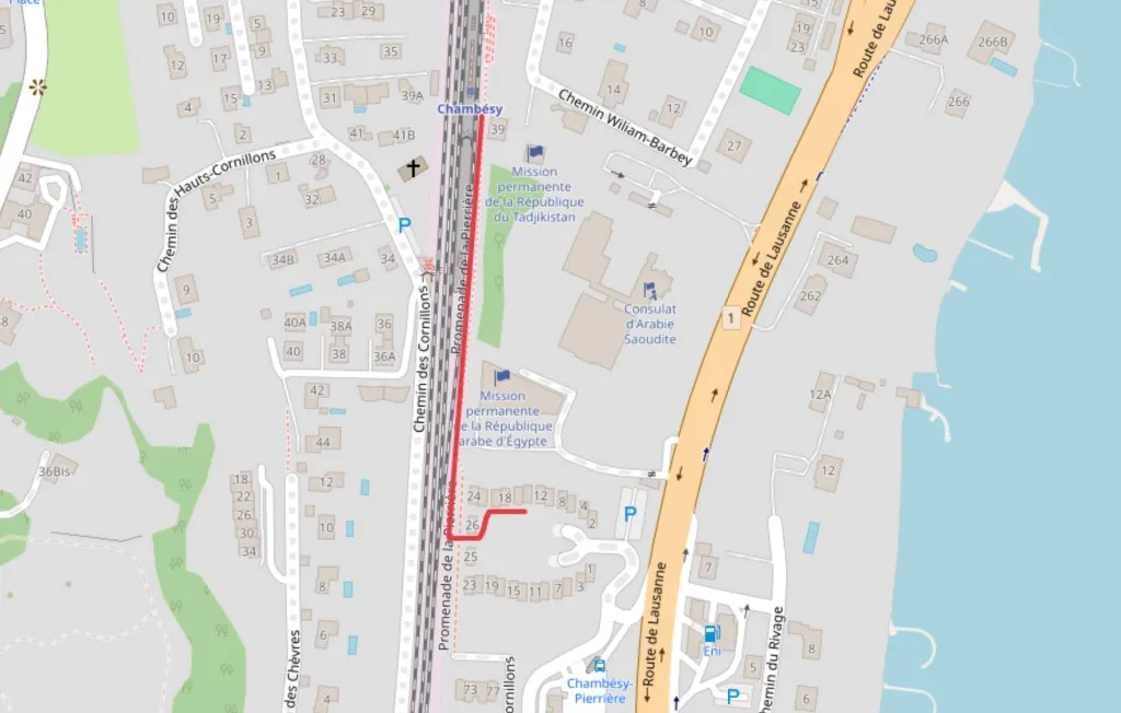
The shortcut: a small pedestrian connection that’s easy to miss in routing.
After the third “are you sure this is the way?” message, I realized I didn’t need a smarter map. I just needed a simple way to show the shortcut.
That’s exactly what Draw on a Map is for.
Most apps I tried felt like overkill for that. I didn’t want to create a project, invite people, log in, manage layers… I just wanted to draw a line and send a link. That’s it.
So me and my partner built Draw on a Map: a simple tool where you can draw lines, arrows, circles (or freehand), pick a color, and share the link. No account, no fuss.
Why navigation apps miss pedestrian shortcuts
Navigation apps optimize for car or general transit routing. OpenStreetMap data includes millions of pedestrian paths, but routing engines do not always surface informal connections: alleys, park cuts, building passageways, or footpaths added by local contributors but not recognized as official routes.
The gap between “the path exists on the map” and “the app routes you through it” is where a hand-drawn shortcut wins every time.
How to share a shortcut in 60 seconds
- Open Draw on a Map
- Search the location
- Use the freehand or line tool to trace the shortcut
- Click Share to copy the link
- Paste the link anywhere: WhatsApp, Telegram, email, SMS
The whole process takes under 60 seconds. The recipient clicks the link and sees your route immediately: no account, no app install.
We still use it all the time for the same kind of thing:
- shortcuts Google Maps doesn’t pick up (like the 2-minute Geneva train station shortcut above, vs the 36-minute detour it suggested)
- hikes or trails that aren’t properly routed
- “walk this way” directions where text gets confusing fast
- meeting spots inside large parks, campuses, or festival areas
When is a drawn route better than a directions link?
A standard directions link gives turn-by-turn instructions. A drawn route shows the path visually. For shortcuts and informal paths, visual beats text every time: there are no “turn left at the third tree” ambiguities.
Drawn routes are especially useful when:
- the shortcut involves a passage or cut-through that has no address
- you want to show two people different parts of the same route
- your recipient is not familiar with the area and needs a visual reference
Draw your own route: it takes under a minute and the share link works on any device.
Related articles
- Draw on Google Maps alternative: when a simple annotation tool beats Google Maps for visual explanations
- Scribble Maps alternative: how Draw on a Map compares to other map drawing tools