Skip to content

Acute Care Hospitals in NJ — New Jersey

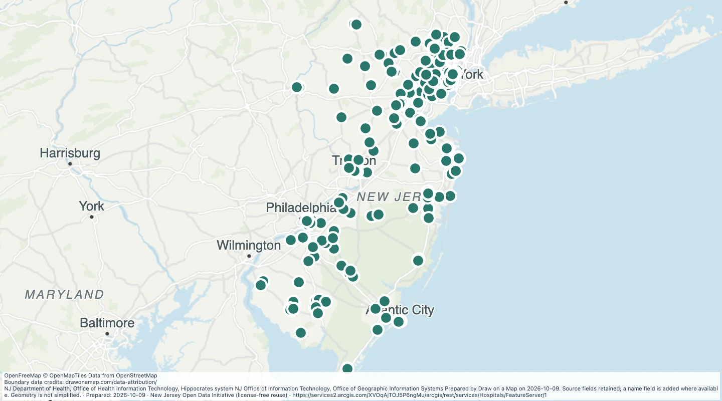
Explore 71 source records for Acute Care Hospitals in NJ — New Jersey. View the map or download the GeoJSON snapshot.

NJ Department of Health (NJ DOH) NJ Department of Health, Office of Health Information Technology, Hippocrates system NJ Office of Information Technology, Office of GIS (NJOGIS) Prepared by Draw on a Map on 2026-10-09. Source fields retained; a name field is added where available. Geometry is not simplified.

Inspect and select records

Choose values to filter the preview. Open or download the matching records.

Loading records from the map preview…

Open selected records
View record table

The table shows up to eight fields. The download keeps all fields and the original geometry.

About this dataset

  • Snapshot prepared on 2026-10-09. This is not a live service. The source update date can be earlier.
  • All 71 records returned by the selected layer are retained. Count and object IDs were checked before download. The selected layer is not a complete inventory of all places in the region.
  • Source coordinates are transformed by the service to WGS84; altitude and measure values are omitted. Geometry is not simplified. Source fields are retained; a display name is added where a source name is available.
  • Original source metadata and reuse evidence: https://drawonamap.com/library/sources/government-2026-10/acute-care-hospitals-in-nj-new-jersey-563e3241.json
  • Retain source credits and the original data limitations.
  • Do not imply that derived data are authoritative survey or official boundary determinations.

Source and licence

New Jersey Office of GIS

Licence: New Jersey Open Data Initiative (license-free reuse)

GeoJSON download details

The download includes all 71 features as points. Coordinates use longitude and latitude in WGS84.

The preparation date is when we prepared this dataset. Read the source notes for the dates covered by the data.

GeoJSON fields 28
OBJECTID
OBJECTID. Source field from New Jersey Office of GIS.
LATITUDE
LATITUDE. Source field from New Jersey Office of GIS.
LONGITUDE
LONGITUDE. Source field from New Jersey Office of GIS.
FACID
FACID. Source field from New Jersey Office of GIS.
FACILITY_TYPE
FACILITY_TYPE. Source field from New Jersey Office of GIS.
ALPHA_NAME
ALPHA_NAME. Source field from New Jersey Office of GIS.
LIC
LIC#. Source field from New Jersey Office of GIS.
LICENSED_NAME
LICENSED_NAME. Source field from New Jersey Office of GIS.
ADDRESS
ADDRESS. Source field from New Jersey Office of GIS.
FAC_ADDR_2
FAC_ADDR_2. Source field from New Jersey Office of GIS.
FAC_CITY
FAC_CITY. Source field from New Jersey Office of GIS.
CSZ
CSZ. Source field from New Jersey Office of GIS.
FAC_ST
FAC_ST. Source field from New Jersey Office of GIS.
ZIP
ZIP. Source field from New Jersey Office of GIS.
COUNTY
COUNTY. Source field from New Jersey Office of GIS.
TELEPHONE
TELEPHONE. Source field from New Jersey Office of GIS.
FAXPHONE
FAXPHONE. Source field from New Jersey Office of GIS.
FACEMAIL
FACEMAIL. Source field from New Jersey Office of GIS.
LIC_EXPIRES
LIC_EXPIRES. Source field from New Jersey Office of GIS.
LICENSED_OWNER
LICENSED_OWNER. Source field from New Jersey Office of GIS.
OWNADDR
OWNADDR. Source field from New Jersey Office of GIS.
ADMIN
ADMIN. Source field from New Jersey Office of GIS.
OWNCSZ
OWNCSZ. Source field from New Jersey Office of GIS.
OWNDESC
OWNDESC. Source field from New Jersey Office of GIS.
TITLE
TITLE. Source field from New Jersey Office of GIS.
RUNDATE
RUNDATE. Source field from New Jersey Office of GIS.
BED_TOTAL
BED_TOTAL. Source field from New Jersey Office of GIS.
name
Display name copied from the source name field.