OBJECTID- OBJECTID. Source field from Geospatial Enterprise Operations.
pod_display- pod_display. Source field from Geospatial Enterprise Operations.
pod_display_short- pod_display_short. Source field from Geospatial Enterprise Operations.
wris_link- pod_link. Source field from Geospatial Enterprise Operations.
snp_id- snp_id. Source field from Geospatial Enterprise Operations.
pod_location_id- pod_location_id. Source field from Geospatial Enterprise Operations.
pod_use_id- pod_use_id. Source field from Geospatial Enterprise Operations.
app_char- app_char. Source field from Geospatial Enterprise Operations.
app_nbr- app_nbr. Source field from Geospatial Enterprise Operations.
permit_char- permit_char. Source field from Geospatial Enterprise Operations.
permit_nbr- permit_nbr. Source field from Geospatial Enterprise Operations.
cert_nbr- cert_nbr. Source field from Geospatial Enterprise Operations.
claim_char- claim_char. Source field from Geospatial Enterprise Operations.
claim_nbr- claim_nbr. Source field from Geospatial Enterprise Operations.
decree_title- decree_title. Source field from Geospatial Enterprise Operations.
transfer_nbr- transfer_nbr. Source field from Geospatial Enterprise Operations.
wr_type- wr_type. Source field from Geospatial Enterprise Operations.
name_last- name_last. Source field from Geospatial Enterprise Operations.
name_first- name_first. Source field from Geospatial Enterprise Operations.
name_company- name_company. Source field from Geospatial Enterprise Operations.
pod_nbr- pod_nbr. Source field from Geospatial Enterprise Operations.
pod_char- pod_char. Source field from Geospatial Enterprise Operations.
source_type- source_type. Source field from Geospatial Enterprise Operations.
use_code- use_code. Source field from Geospatial Enterprise Operations.
use_category- use_category. Source field from Geospatial Enterprise Operations.
use_code_description- use_code_description. Source field from Geospatial Enterprise Operations.
priority_date- priority_date. Source field from Geospatial Enterprise Operations.
duty- duty. Source field from Geospatial Enterprise Operations.
rate_cfs- rate_cfs. Source field from Geospatial Enterprise Operations.
rate_cfs_est- rate_cfs_est. Source field from Geospatial Enterprise Operations.
max_rate_cfs- max_rate_cfs. Source field from Geospatial Enterprise Operations.
acre_feet- acre_feet. Source field from Geospatial Enterprise Operations.
acre_feet_est- acre_feet_est. Source field from Geospatial Enterprise Operations.
max_rate_acre_feet- max_rate_acre_feet. Source field from Geospatial Enterprise Operations.
source- source. Source field from Geospatial Enterprise Operations.
tributary_to- tributary_to. Source field from Geospatial Enterprise Operations.
streamcode- streamcode. Source field from Geospatial Enterprise Operations.
stream_name- stream_name. Source field from Geospatial Enterprise Operations.
supplemental- supplemental. Source field from Geospatial Enterprise Operations.
begin_month- begin_month. Source field from Geospatial Enterprise Operations.
begin_day- begin_day. Source field from Geospatial Enterprise Operations.
end_month- end_month. Source field from Geospatial Enterprise Operations.
end_day- end_day. Source field from Geospatial Enterprise Operations.
technician_initials- technician_initials. Source field from Geospatial Enterprise Operations.
agency- agency. Source field from Geospatial Enterprise Operations.
rec_creation_date- rec_creation_date. Source field from Geospatial Enterprise Operations.
last_updt_date- last_updt_date. Source field from Geospatial Enterprise Operations.
feature_quality_code- feature_quality_code. Source field from Geospatial Enterprise Operations.
remarks- remarks. Source field from Geospatial Enterprise Operations.
name- Display name copied from the source name field.
 Draw on a Map
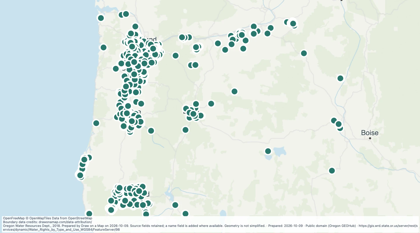 Map features: 6,395
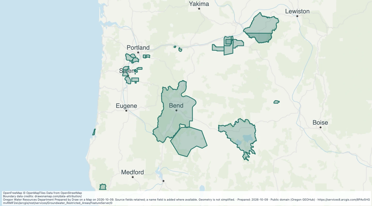 Map features: 29
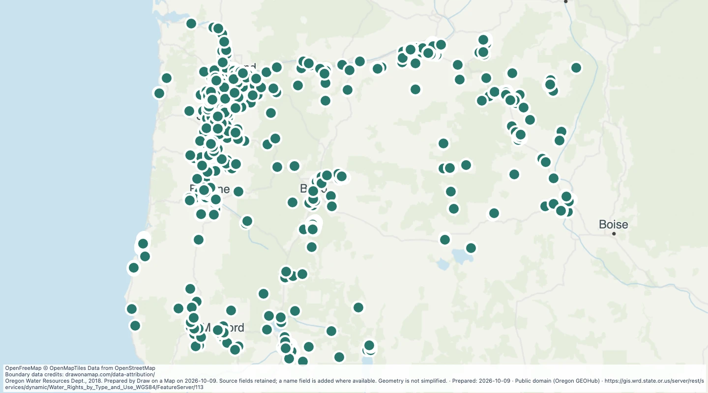 Map features: 1,576