 Draw on a Map
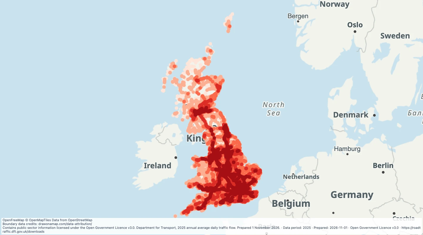
Great Britain road traffic volumes, 2025
Compare annual average daily traffic at road count points across Great Britain, with vehicle types and source estimation methods.
Inspect and select records
Choose values to filter the preview. Open or download the matching records.
Loading records from the map preview…
View record table
The table shows up to eight fields. The download keeps all fields and the original geometry.
About this dataset
- The map includes all 2025 annual average daily flow records from the DfT download, with one point per count-point identifier. Northern Ireland is not included.
- Values describe the average day across 2025 and both directions of travel. They do not show live congestion, pedestrian footfall, or traffic at a particular hour.
- Coverage includes major roads and a sample of minor roads. The absence of a point does not mean a road has no traffic.
- Keep Counted and Estimated records distinct. Some estimates use earlier counts, so local figures can be less reliable than regional totals.
- Darker red points show higher motor-vehicle flow. Select a point to read its value range, vehicle counts, and estimation method.
Source and licence
Licence: Open Government Licence v3.0
GeoJSON download details
The download includes all 22,334 features as points. Coordinates use longitude and latitude in WGS84.
The preparation date is when we prepared this dataset. Read the source notes for the dates covered by the data.
GeoJSON fields 13
name- Road, local authority, and count-point identifier.
count_point_id- DfT count-point identifier.
all_motor_vehicles- Estimated average motor vehicles per day in both directions during 2025.
estimation_method- Counted or Estimated, as supplied by DfT.
year- Year of annual traffic estimate.
road_name- Source road name.
local_authority- Source local authority name.
cars_and_taxis- Average cars and taxis per day.
light_goods_vehicles- Average light goods vehicles per day.
heavy_goods_vehicles- Average heavy goods vehicles per day.
pedal_cycles- Average pedal cycles per day.
estimation_method_detail- Source description of the counting or estimation method.
value_range- Display range for daily motor-vehicle flow.