 Draw on a Map
Turn a list of locations into a map with one marker for each row. Use it to check meeting points, plan site visits, or show several locations on one page.
Start with the sample below. It contains five example stops near central Paris, with coordinates, colors, and notes. The stop names are sample labels.
Prepare your spreadsheet
Put column names in the first row. Add one location per row below it. Use separate latitude and longitude columns with WGS84 decimal degrees, as in this sample:
name,latitude,longitude,color,notes
West stop,48.8629,2.2870,#2563eb,Example meeting point
Tower stop,48.8584,2.2945,#2563eb,Example photo stop
Garden stop,48.8560,2.3125,#16a34a,Example rest stop
River stop,48.8637,2.3212,#16a34a,Example pickup point
Museum stop,48.8606,2.3376,#9333ea,Example final stop
Keep name for the location label. Use color for a six-digit color code such as #2563eb. Other columns, such as notes, stay with each accepted location.
If your list contains only street addresses, add coordinates before import. This importer does not look up addresses. A supported WKT geometry column is another option for files that already contain geometry.
Save your file as CSV, TSV, or XLSX. For an older .xls file, save a copy as .xlsx first.
Import the sample
- Open Draw on a Map.
- Select Import / Export in the toolbar.
- Select Import data file.
- Select Choose files in the import dialog.
- Choose
paris-locations.csvfrom your downloads.
The Import spreadsheet dialog opens. For an Excel workbook with several sheets, select the sheet that contains your locations.
Check the columns and preview
- Set Latitude to
latitude. - Set Longitude to
longitude. - Set Label to
name. - Leave WKT geometry set to Not used for this sample.
- Open More options.
- Set Color to
color. - Leave Route or group and Route order set to Not used.
The sample headers normally select these columns for you. With no route group, each row becomes a separate marker.
Check that the preview shows 5 valid rows, 0 skipped rows, 5 map features. Then select Import locations.
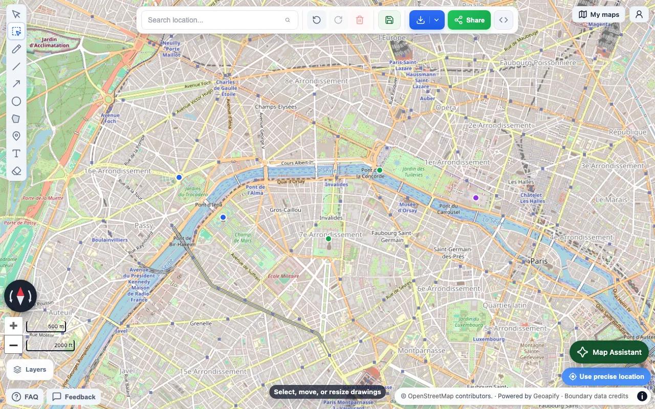
You now have five locations in an imported data layer. Check their positions before you use the map.
Check the stored notes
- Select Layers.
- Open the imported layer’s More actions menu.
- Select View data.
- Check that the five rows include the
notescolumn.
The map keeps the columns from accepted rows. Spreadsheet formatting is not a map style. Use the import options to set marker colors.
Save or export your map
Select Save and sign in to keep an editable map in your account. A free map can save one data layer with up to 1,000 features. Pro is required to save more imported layers or larger layers. The import limits below still apply.
To send an interactive map, select Share after you save the imported data. Open the resulting link to check the recipient’s view.
To use the map in a document, open Import / Export and select a PNG or PDF preview. Check the map before you download it. Free downloads have a watermark. Exports without a watermark require a one-time purchase or Pro.
To move the location data to another map tool, use Export GeoJSON in the imported layer’s menu.
If your file does not import
- If the preview shows skipped rows, check for empty coordinates or text in the coordinate columns. Latitude must be between -90 and 90. Longitude must be between -180 and 180.
- If locations appear in the wrong place, check that latitude and longitude are not reversed. Use decimal degrees, not projected meter coordinates.
- If only addresses are available, obtain coordinates before import. Renaming an address column to
latitudedoes not convert its values. - If the file exceeds 15 MiB or 50,000 data rows per sheet, split it into smaller files. Large Excel workbooks can also exceed the unpacked-file limits.
- If an Excel workbook cannot be read, save the location sheet as CSV and try again.
The importer also limits unpacked Excel content to 8 MiB per internal file, 16 MiB in total, and 128 internal files. These limits can reject a workbook below 15 MiB. A successful import does not remove the free-plan save limits.
Keep your original spreadsheet until you have checked the imported locations and notes.
Open the map and import your locations