Skip to content

Show volunteers where to meet and work

Draw a meeting point, mark the approach route, and outline the work area. Send volunteers one map link with the locations they need.

Free to draw and share. No account needed.
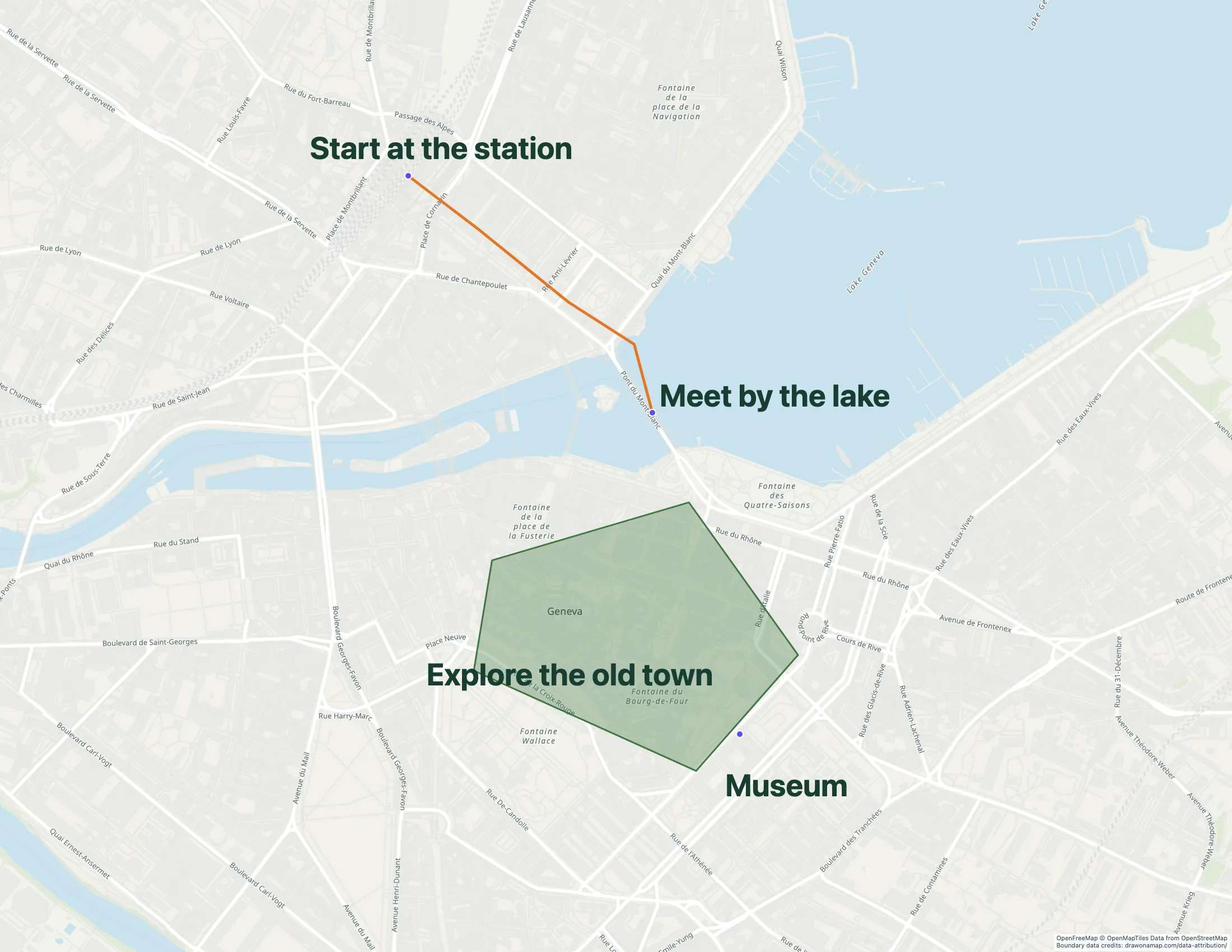
A Geneva walking route with annotations shows how routes and notes can work together on a map.

Make the map you need.

Mark the meeting point

Find the site and add a marker at the entrance volunteers should use. Add a short label that matches your written instructions.

Draw the route and work area

Mark the path from the meeting point to the work area. Outline the area for the activity so volunteers can see its boundaries.

Send the briefing

Share the standard map link with your volunteer instructions. Include the meeting time and contact details in the message.

What you can make

Use Draw on a Map to show volunteers where to meet, which route to follow, and where to work. Core drawing and standard share links are free. Compare directory and geographic data tools when your project needs those features.

At a glance

Match the tool to your task
ToolBest forCost and access
Draw on a MapA volunteer meeting or area briefingFree drawing and standard sharing. Image/PDF exports and some sharing features are paid.
MapmeA public service directoryStarter is $50/month or $360/year. Higher plans add imports and more locations.
FeltGeographic data and shared reviewPersonal is free for non-business use without file uploads. Business use needs a paid plan; a trial is available.

Choose what your map needs

1. Draw on a MapOur product

Best for
A volunteer meeting or area briefing
Cost
Free drawing and standard sharing. Image/PDF exports and some sharing features are paid.

Put the meeting point, route, and work area on one map for a cleanup, collection, or community event. Core drawing and standard share links are free. PNG and PDF downloads are free with a watermark.

Check the fit: you need case management, access controls for sensitive records, or a maintained service directory.

Open Draw on a Map

2. Mapme

Best for
A public service directory
Cost
Starter is $50/month or $360/year. Higher plans add imports and more locations.

Compare Mapme when visitors need to browse service locations and categories. A directory needs location details and someone responsible for keeping them current.

Check the fit: the locations should not be public, or the project only needs a temporary meeting map.

Mapme product details

3. Felt

Best for
Geographic data and shared review
Cost
Personal is free for non-business use without file uploads. Business use needs a paid plan; a trial is available.

Compare Felt when the work involves geographic data and team review. Check its current business plan and nonprofit eligibility for your organization.

Check the fit: you only need to mark a meeting point, route, or work area for a volunteer briefing.

Felt product details

Give volunteers a map they can use on arrival

For a park cleanup, mark the meeting entrance and outline the collection area. For a community event, show the approach route and the place to unload supplies. Use short labels that match the names in your volunteer message.

Keep the map focused on the activity. Put the meeting time, contact details, and essential instructions in the message that accompanies the link. Volunteers can then read those details even if the map does not load.

Core drawing and standard map links are free. If you need an image or PDF for a printed briefing, download a free watermarked copy or remove the watermark with Pro. To edit together in real time, save the map and invite others with Pro.

Choose a directory when visitors need service information

A public service directory has a different job from a volunteer briefing. Visitors may need service hours, eligibility details, and location categories. Compare directory tools when those details are central to the task.

Assign an owner to check hours and location changes. Before publication, ask someone to find a service they could visit. Check the page on a phone and with keyboard controls.

Publish the information the activity needs

A food-bank address can belong in a public directory. A beneficiary’s home address may not. Use only information approved for public release, and remove personal fields that the map does not need.

For sensitive records, use a system with suitable access controls. An unlisted link alone does not provide that protection. Check what a person outside the team can see before sharing the map.

Match the tool to the work

Start with Draw on a Map for a volunteer briefing. If you need to compare service coverage with geographic data, assess a GIS workflow. A drawn area or a set of markers alone does not measure unmet demand.

Include staff time, training, and ongoing updates when you compare costs. The Felt comparison explains the difference between a drawing tool and a geographic data workspace.

Questions

Can our nonprofit make a volunteer map for free?

Yes. Core drawing and standard share links are free in Draw on a Map. PNG and PDF downloads are free with a watermark. Real-time collaboration on a saved map requires Pro.

Can I put beneficiary addresses on a public map?

Use only information approved for public release. Remove personal fields that the map does not need and follow your organization's data rules.

Does every nonprofit get a free Felt business plan?

Check Felt's current nonprofit eligibility and plan terms. Its Personal tier is for non-business use and does not include file uploads.