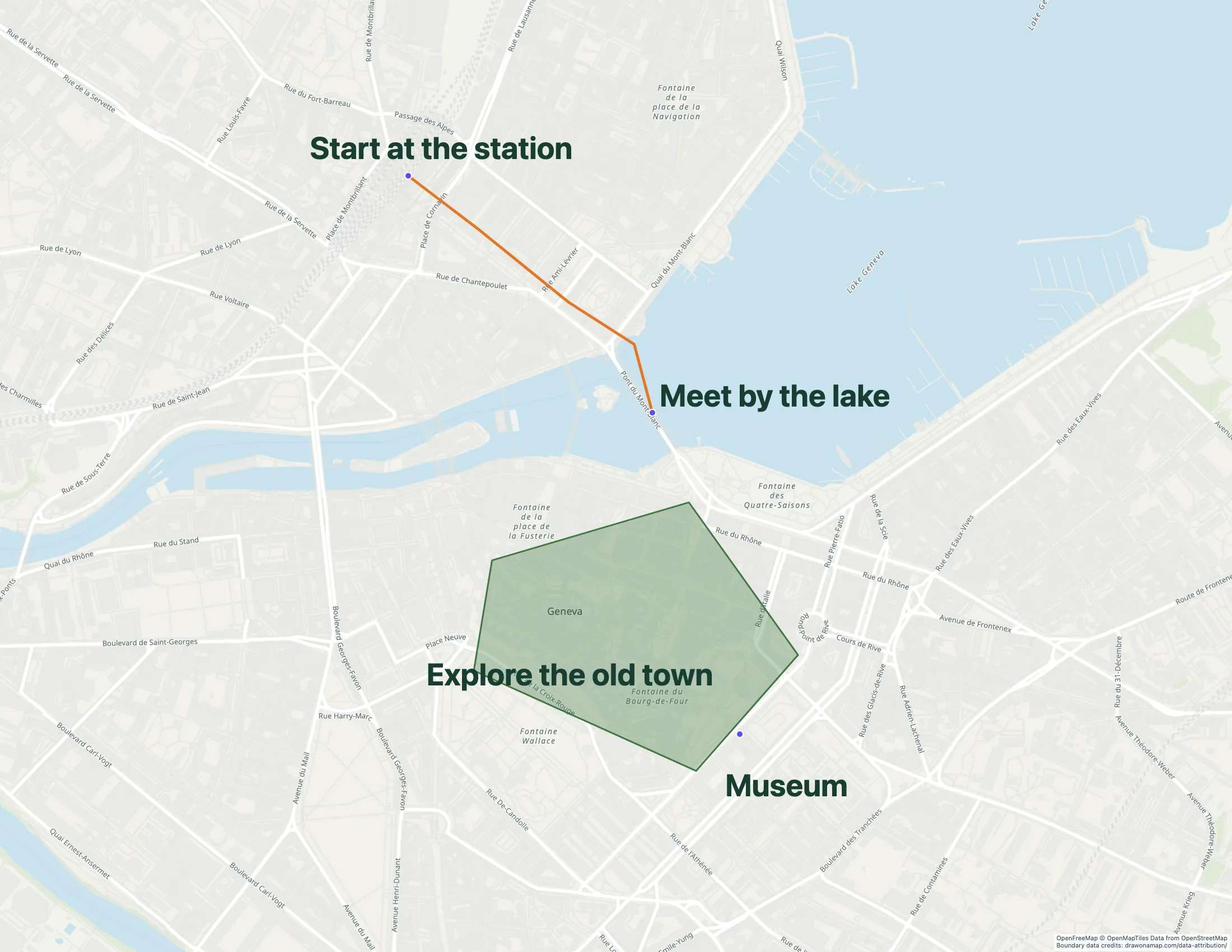
A Geneva walking route with annotations shows how route lines and notes can explain an approach.
Make the map you need.
01
Mark the arrival points
Find the property and mark its entrance, parking, and meeting point. Use separate labels when these places are on different streets.
02
Explain the approach
Draw the approach from a station or car park. Add notes for entrances that are difficult to find.
03
Send the map before the viewing
Share a free standard link with your client. For a printed viewing pack, export a PNG or PDF.
What you can make
Use Draw on a Map to show clients where to meet, park, and enter a property. Add nearby places and share the map before a viewing. Drawing and standard share links are free. PNG and PDF downloads are free with a watermark.
Trial available. $250 for 45 days; Pro is $110/month or $1,250/year.
Choose what your map needs
1. Draw on a MapOur product
Best for
A property viewing or neighborhood briefing
Cost
Free drawing and standard sharing. Image/PDF exports and some sharing features are paid.
Put the entrance, parking, and nearby places on the same map. Add a route and notes to answer the questions clients ask before a viewing. Free drawing and standard links make it easy to share the result.
Check the fit: you need a cadastral record, a boundary survey, or demographic analysis. A drawing does not establish those facts.
Starter is $50/month or $360/year. Higher plans add imports and more locations.
Consider a directory tool when visitors need to browse multiple listings with categories and location media. Test it with your actual listing content before choosing a plan.
Check the fit: you only need to explain how to reach a viewing. A map with a route and notes can cover that task.
Trial available. $250 for 45 days; Pro is $110/month or $1,250/year.
Consider an analysis tool when your work depends on comparisons across business or demographic data. Check that it supports the data and measures you need.
Check the fit: you only need to send arrival instructions to a client.
A street address can take a client to the front of a building while the viewing starts at a side entrance. Mark the place where you will meet. Add a note for a gate, courtyard, or car park that is difficult to find.
Include nearby places that help explain the location. Keep labels short enough to read on a phone. Check the route and entrance before you send the map, especially when building work changes access.
Choose how clients receive the map
A standard share link gives clients a map to open before the viewing. Core drawing and standard links are free. For viewing packs and printed handouts, export a PNG or PDF. Pro removes the watermark.
To edit with another agent in real time, save the map and invite them with Pro.
Use verified records for property facts
A drawn outline can help explain an approximate area. Use verified property records for legal boundaries and other material property facts. Show the source and date if you include those facts in the map.
Keep listing maps current
If you maintain maps for several properties, assign someone to update them when listings change. Record the source of each location and description, and remove or mark unavailable listings. Keep the address and contact information in readable page text as well as on the map.
A directory has different needs from a viewing map. The Mapme comparison explains the difference between a shared drawing and a listing directory.
Questions
Can I make a property viewing map for free?
Yes. Drawing and standard share links in Draw on a Map are free. PNG and PDF downloads are free with a watermark.
Can I use a drawn outline as a property boundary?
Use verified property records for boundary claims. A drawing can illustrate an area, but it does not establish a legal boundary. Label illustrative outlines as approximate.
Which option is best for a property website?
Use Draw on a Map for an access map that explains entrances, parking, and nearby places. If visitors need to browse many listings by category and open location media, assess a property directory tool such as Mapme.
Can another agent edit the map with me?
Real-time collaboration in Draw on a Map requires Pro. Save the map first. You can then invite collaborators.