Skip to content

Show your group where to go

Draw a walking route and mark the exact meeting point. Add short notes so your group can follow the plan from one shared map.

Free to draw and share. No account needed.
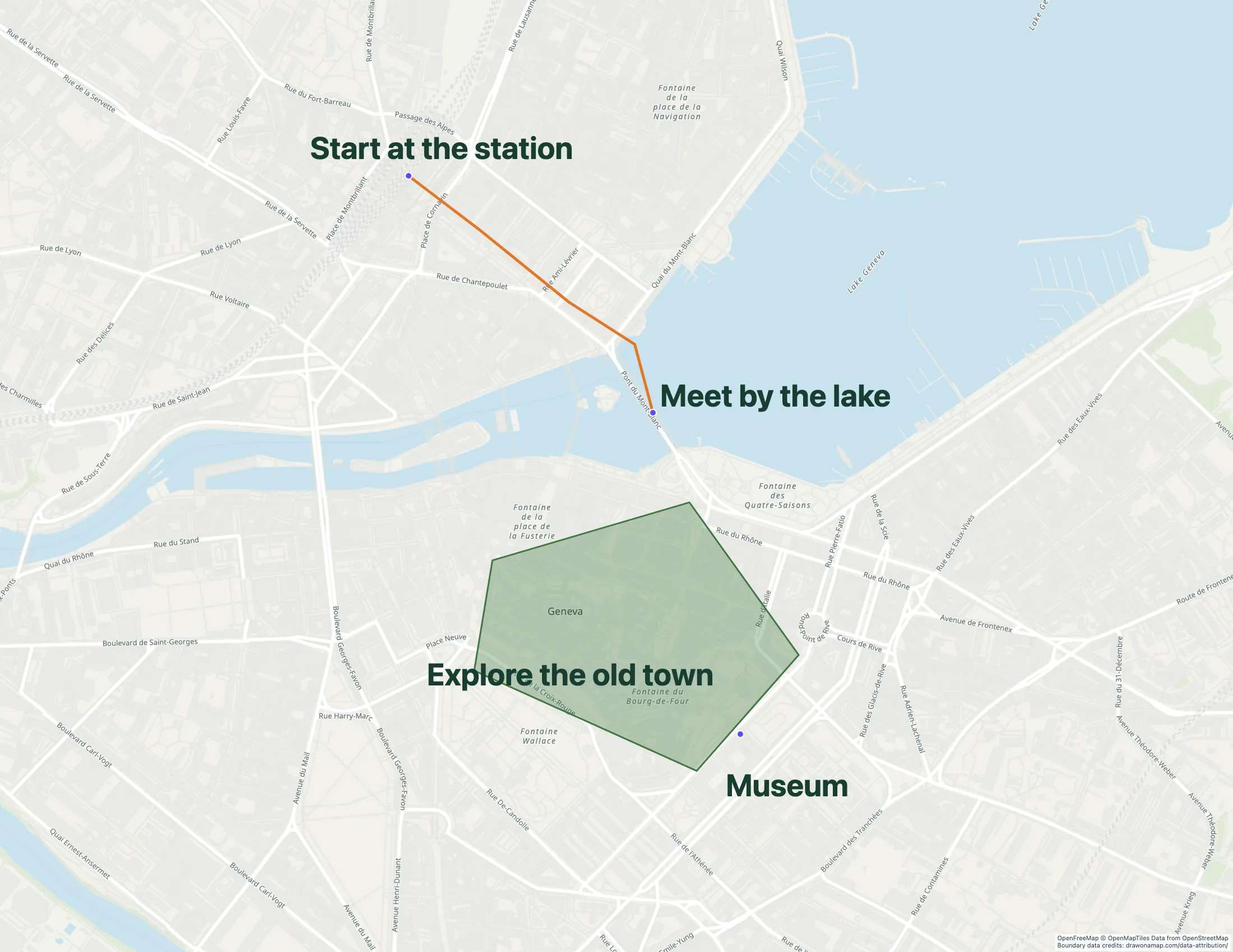
A Geneva walking route with annotations that explain the route.

Make the map you need.

Mark the start and finish

Find the area for your trip. Mark the meeting point and the final stop with clear labels.

Explain the route

Draw the route between stops. Add arrows and notes where an entrance or turn needs an explanation.

Share the plan

Send a standard share link to your group. Open it on your phone to check the labels before departure.

What you can make

Use Draw on a Map to explain a walking route or show a meeting point with arrows and notes. Core drawing and standard share links are free. For other travel tasks, compare a shared place list in Google My Maps with a public destination guide in Mapme.

At a glance

Match the tool to your task
ToolBest forCost and access
Draw on a MapA route explanation or meeting pointFree drawing and standard sharing. Image/PDF exports and some sharing features are paid.
Google My MapsA group trip place listFree with a Google account.
MapmeA public destination guideStarter is $50/month or $360/year. Higher plans add imports and more locations.

Choose what your map needs

1. Draw on a MapOur product

Best for
A route explanation or meeting point
Cost
Free drawing and standard sharing. Image/PDF exports and some sharing features are paid.

Draw a line between stops, add arrows at turns, and label the exact meeting point. Share the map with a standard link. Inviting others to edit in real time requires Pro.

Check the fit: you need live navigation, transit schedules, or offline navigation.

Open Draw on a Map

2. Google My Maps

Best for
A group trip place list
Cost
Free with a Google account.

Collect places in a shared map alongside your Google Drive documents. This suits a group that wants to keep a list of possible stops and edit place details.

Check the fit: you want to start a route sketch without an account.

Google My Maps product details

3. Mapme

Best for
A public destination guide
Cost
Starter is $50/month or $360/year. Higher plans add imports and more locations.

Publish attractions by category with media at each location. This suits a destination guide that you maintain for website visitors.

Check the fit: you only need to explain a route or share a meeting point.

Mapme product details

Make the meeting point easy to find

An address can identify a building without showing the correct entrance. Mark the entrance on your map. Add a short note such as “Meet at the north gate” and an arrow that shows the approach.

For a walk with several stops, keep confirmed stops separate from optional places. Use a clear label for each day or route segment. See the walking-directions example for a route with notes.

Choose how your group will use the map

A standard share link works for sending your plan. If the group needs to change the map together, save it and invite collaborators. Inviting collaborators requires Pro.

Core drawing and standard links are free. PNG and PDF downloads are free with a watermark. An exported copy can support a printed trip plan, while the share link lets the group open the map in a browser.

Check the map before departure

Open the shared map on the phone you will use for the trip. Check that route labels and meeting notes are easy to read. Ask the other travellers to open the link too.

A drawn route explains the intended journey. Use a navigation tool for live directions, and check current access before departure. If you expect poor connectivity, prepare a separate reference and test it without a connection. Keep booking and contact details available outside the map.

Keep a public destination guide current

A public guide needs more detail than a map for one trip. Give each attraction a clear name and assign someone to check opening hours and access details. Add a review date so the guide has a clear maintenance schedule.

Questions

Can I make and share a travel map for free?

Yes. Core drawing and standard share links in Draw on a Map are free. PNG and PDF downloads are free with a watermark.

Can my group edit the map together?

Yes. Save the map, then invite collaborators for real-time editing. Inviting collaborators requires Pro.

Does a drawn route provide live navigation?

No. A drawn route explains your plan. Use a navigation tool for live directions and check current access before the trip.

Which tool fits a shared holiday place list?

Google My Maps fits a group that uses Google accounts and wants to maintain a shared list of places. Use Draw on a Map when you want to explain the route between stops or show an exact meeting point.